Despite spending sums of money on mapping software, what businesses receive are unsatisfactory results.
In fact, the global location intelligence market reached $21.21 billion in 2024, according to current industry data, and it continues growing at 16.8% annually through 2030.
And with organization treating spatial analysis as a core business function to achieve discovering the alternatives for mapping becomes a necessity.
Discussions state that there are two major platforms enabling location intelligence: Maptive and Maptitude.
Read this article to know which alternative would suit your business the best!
Key Takeaways
- Comparing both Maptive and Maptitude to analyze which method is best suited for deep location intelligence.
- Analyzing factors such as processing power under pressure, demographic analysis, territory reaction, etc., on the Maptive method.
- Carrying out a pricing differentiation to know what suits the business models well.
- Holding security and uptime matters to judge which method suits a long-term goal.
Maptive processes up to 100,000 location points through standard operations. The platform runs three to five times faster than comparable tools when loading complex layers or large CSV files.
During spikes in claims, the system allows insurance companies to process over 250,000 geocodes per minute, which directly improves customer service response times.
The geocoding engine powering Maptive draws on Google Maps infrastructure, plotting addresses at 10 per second.
While enterprise clients process over a million geocodes each month and generate up to 500 private maps, team plan subscribers can geocode up to 400,000 addresses.
These figures matter when organizations need to analyze large customer databases or assess regional sales performance across thousands of locations.
Capable platforms are distinguished from adequate ones through route planning. In contrast to most competitors, Maptive’s route optimisation manages a high number of stops per route—roughly 50. By utilising the platform, delivery operations and field service firms can increase daily visits without compromising accuracy.
Field tests conducted by logistics teams revealed routing errors dropped 22% after switching to Maptive.
One field service company documented an 18% decrease in fuel costs alongside a 22% increase in completed service calls after adopting Maptive iQ, the platform’s advanced feature set released in March 2025.
Location intelligence gains value when combined with population data. Maptive automatically provides demographic information from the U.S. Census, allowing users to overlay population density, age distributions, median household income, race, and education levels without uploading additional files. The demographic layer can pinpoint underserved areas with up to 90% precision based on source data.
Demographic maps by state, city, county, zip code, census tract, or block group can be made by users.
Organisations that operate in both countries can also access data from the Canadian census. Marketers can now target regions with high purchase intent thanks to Maptive iQ’s introduction of new data streams, such as mobile signals and purchasing trends.
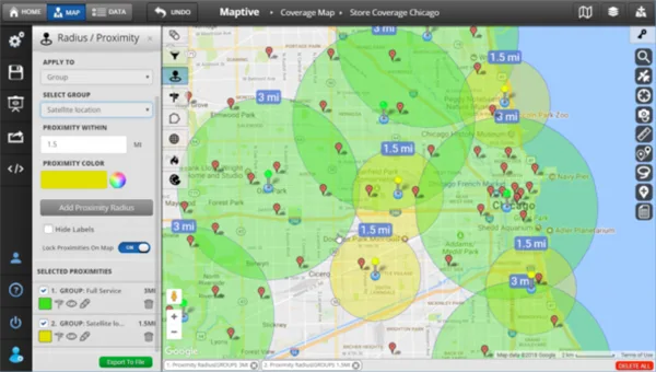
Territory management consumes hours when done manually.
Maptive iQ introduced a combinatorial boundary feature that allows users to draw territories using any combination of official geographic lines and custom areas.
If a customer catchment covers three postal codes plus the blocks surrounding a shopping center, that entire area becomes one unified territory.
For automated territory assignment, some organisations already sync more than 50,000 leads each week. 89% of beta users said that using heatmaps and assessing territory was simpler during testing stages. The platform receives 5.0 out of 5 for location tracking, 5.0 for geocoding, and 5.0 for heatmaps in G2 feature ratings from verified users.
Data loses value when it sits in isolation. Maptive connects directly with Salesforce, Zoho, Keap, Pipedrive, and HubSpot.
The lag time for beta users syncing with Salesforce report map updates is less than 90 seconds. Real-time connections between CRM systems and Maptive iQ enable Salesforce users to automatically sync data without the need for manual uploads.
The Maptive Heat Map Generator visualizes and identifies trends in location data on a Google map foundation.
This means users can employ heat mapping to visualize marker density or numerical data tied to geographic locations.
Customization options include adjusting radius, opacity, intensity threshold, and gradient colors.
In one documented use case, Tesla Supercharging stations and electric vehicle distributions were mapped by zip code to produce density maps that showed infrastructure gaps. This kind of analysis shows how heat mapping turns unprocessed location data into useful information.
The platform maintained 99.9% uptime through 2025 with zero major system outages. Data protection includes 256-bit encryption, two-factor authentication, and disaster recovery protocols.
Maptive is licensed with Google’s enterprise-level mapping services, providing access to continuously updated geographic information.
Features include :
For organizations handling sensitive customer location data, these protections matter.
Maptive offers four pricing editions ranging from $250 to $2,500.
When users sign up for the trial, they gain immediate access to create demographic maps based on U.S. Census data. Upgrading to add more users and advanced features can happen at any time without switching platforms or migrating data.
With Maptive, support begins right away. Users can interact with real people who are familiar with the platform through live chat. Common tasks are covered in video tutorials, and specific questions are addressed in the knowledge base. For users seeking a deeper understanding, weekly webinars showcase advanced features.
Users rate support highly because responses arrive quickly and problems reach resolution. There are no ticket systems and no waiting days for answers.
For teams implementing location intelligence tools for the first time, responsive support shortens the path from installation to productive use.
Support for point cloud files that produce precise three-dimensional mapping models will be one of the options available to research and data science teams. As part of site analysis and planning, property and construction managers will be able to map spatial and vertical data.
Expanded international support is coming gradually, with 13 languages promised by 2026.
These additions extend the platform’s usefulness for organizations operating across multiple countries and languages.
For businesses that need deep location intelligence, Maptive is the best choice.
In a browser-based interface that doesn’t require any knowledge of GIS, the platform combines processing speed, real-time CRM integration, demographic overlays, and route optimisation.
For their location intelligence needs, businesses like Amazon, GE, and Coca-Cola rely on the platform.
The combination of 60+ analysis tools, Google Maps foundation, responsive support, and continuous feature development positions Maptive as the practical choice for businesses at any scale.
From small teams needing basic territory mapping to major logistics operations processing millions of geocodes monthly, the platform delivers measurable results.